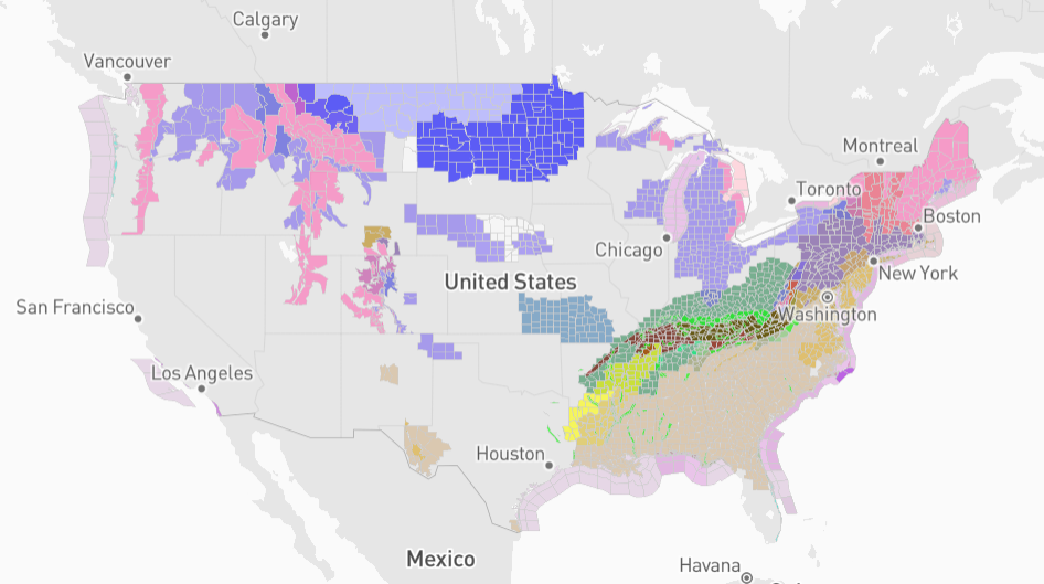
Flash Flooding Ravages Eastern United States, Prompting Emergency Declarations
A powerful storm has brought life-threatening flooding to the eastern half of the United States, prompting emergency declarations and extensive flash flood warnings. The National Weather Service (NWS) has issued a dire warning, urging millions of Americans to seek shelter as heavy rainfall, severe thunderstorms, and possible tornadoes impact vast areas of the country.
Regions at High Risk
The storm, forecast to hit parts of Tennessee and Kentucky with particular severity, is expected to unleash several inches of rainfall. Portions of the Ohio Valley, Tennessee Valley, and Lower Mississippi Valleys are at an elevated risk of widespread showers, thunderstorms, and flash flooding as the storm moves eastward towards the Appalachians.
Dangerous Flash Flooding
The NWS has designated northwestern Tennessee and western Kentucky as areas facing the most severe threat. A high risk of excessive rainfall has been identified in these regions, and flash flooding poses a significant danger. Kentucky Governor Andy Beshear has declared a state of emergency to ensure swift response and emergency preparedness.
Urban and Hilly Areas Particularly Vulnerable
Experts warn that urban and hilly areas are especially susceptible to deadly flooding. Water levels on small streams and roads can rise rapidly, increasing the risk of vehicle entrapment and hazardous driving conditions. Emergency management officials have already reported water rescues underway in south central Kentucky, where rainfall measurements have exceeded three inches.
Tornado Threat and Flood Warnings
The Storm Prediction Center (SPC) has issued a severe weather alert for the Lower Mississippi Valley and central Gulf Coast. AccuWeather expert Guy Pearson advises that the storm may produce multiple tornadoes, further intensifying the threat to impacted regions.
Nearly 500-Mile Stretch Under Flash Flood Warnings
As of Saturday afternoon, a 500-mile stretch of flash flood warnings extends from eastern Arkansas to eastern Kentucky. The NWS urges residents to avoid driving through flooded areas, as even shallow water depths can cause significant damage.
Rivers on Verge of Flooding
The intense rainfall poses a threat of riverine flooding, as heavy precipitation combines with earlier rainfall this week. Multiple secondary rivers in Kentucky and Tennessee are forecast to experience moderate to major flooding.
Flood Risk Lessens, but Threat Persists
While the flooding risk may gradually decrease as a cold front approaches and storms move away, some areas along the eastern coast remain at risk for isolated flash flooding. The storm is expected to largely wind down by Sunday evening as the front moves into the Atlantic Ocean.
Call for Caution and Preparedness
Governors and emergency management officials throughout the affected areas are urging residents to heed warnings, stay safe, and avoid floodwaters. Residents should monitor weather updates, heed evacuation orders if necessary, and have emergency plans in place.
Stay Informed
For the latest weather reports and safety updates, residents are advised to follow official sources such as the National Weather Service and local emergency management agencies.
