
Greenland: A Land Larger in Imagination Than Reality?
President Donald Trump’s interest in Greenland sparked widespread discussion, highlighting the strategic and resource potential of the island nation. However, this interest also brought to the forefront a long-standing cartographic misconception: the distorted perception of Greenland’s size on most world maps. For centuries, the common flat world map has presented a skewed view of Greenland, leading many to overestimate its actual dimensions. While Greenland is undeniably large, its true size is significantly smaller than it appears on these familiar projections.
Greenland’s vastness is undeniable; it is approximately three times the size of Texas. However, on many maps, it looms as large as the entire continent of Africa. This is a gross exaggeration. In reality, Greenland is approximately 14 times smaller than Africa. The discrepancy becomes readily apparent when comparing Greenland’s size to scale on a globe, providing a more accurate representation of its proportions relative to other landmasses.
The root of this distortion lies in the challenge of representing a spherical planet on a flat surface. Creating a flat map that accurately depicts the Earth necessitates some degree of compromise. The most common map projections used today prioritize the accuracy of shapes and relative positions in certain regions, often at the expense of accurate size representation, particularly for areas closer to the poles.
Imagine attempting to cover a balloon with pieces of wet newspaper. To create a smooth surface, the paper must be scrunched and distorted, especially at the poles. Similarly, flat map projections must distort certain aspects of the globe to achieve a manageable representation. To maintain the shape and relative position of landmasses in the middle of the globe, the areas near the poles are often stretched and enlarged.
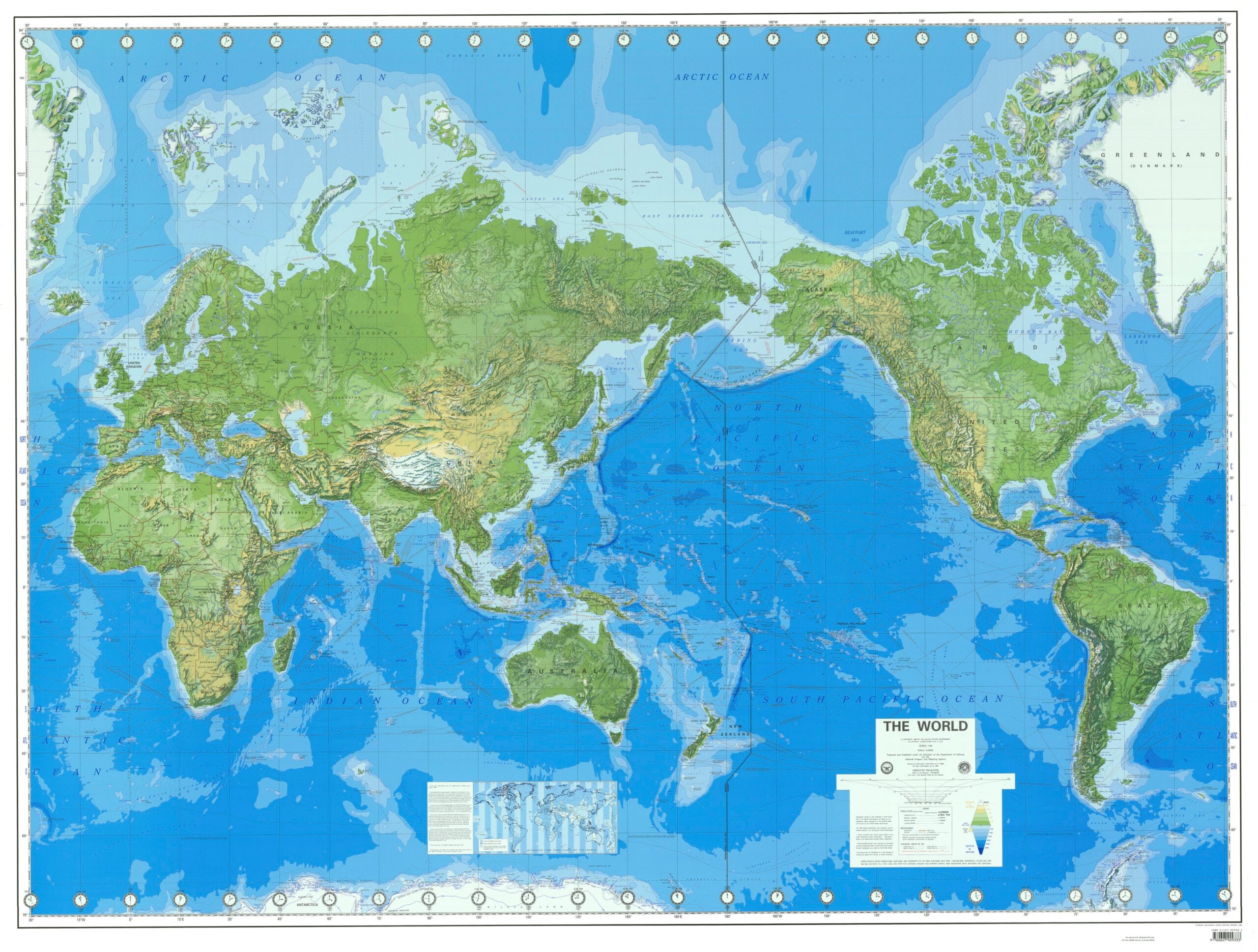
This issue is exemplified by the widely used Mercator projection. Developed in 1569 by Flemish geographer Gerardus Mercator, this projection excelled at accurately depicting the shapes of countries and proving vital for navigation, especially for charting ocean sailing courses that were essential for merchants of the time. It also provided a reasonably accurate depiction of Europe.
However, the Mercator projection came at the cost of accurately representing the size of landmasses further north and south. Antarctica, Greenland, and Russia appear significantly larger than their actual sizes in this projection. While the shapes of these landmasses are relatively accurate, their perceived size is greatly exaggerated.
Alternative map projections exist that address this distortion of size. However, these projections often appear unconventional and convoluted to those accustomed to the Mercator projection. Because most people grow up with the Mercator projection, they develop an intuitive sense of the world based on its distorted representation. Consequently, maps that accurately depict size might seem "wrong" or unfamiliar.
For those seeking a more accurate understanding of relative landmass sizes, interactive tools are available. One notable example is "The True Size Of," a website that allows users to drag and drop countries onto the map and compare their actual sizes. This tool provides a powerful visual demonstration of the distortions inherent in traditional map projections and allows for a more informed understanding of global geography.
Despite the distortions of conventional maps, Greenland remains a significant landmass. Depending on the definition of its political status, it ranks among the 12th largest nations or territories in the world. This inherent size contributes to its strategic importance, particularly in light of growing interest in Arctic resources and shipping routes.
Public opinion surveys have revealed mixed reactions to the idea of the United States acquiring Greenland. A significant percentage of Americans view such a proposition unfavorably. These opinions likely reflect a range of considerations, including financial implications, geopolitical strategy, and the historical and cultural significance of Greenland.
It’s important to note that Greenland is not an independent country but a self-governing territory within the Kingdom of Denmark. Its history as a Danish colony dates back to 1721, and it was granted self-governance in 2009. The island’s 56,000 residents have their own government and parliament, responsible for managing internal affairs. However, Denmark retains control over Greenland’s foreign policy and defense. Greenlanders are Danish citizens.
The sheer size of Greenland, roughly 20 times that of Denmark, further underscores the unique relationship between the island and its governing nation. Despite its relative autonomy, Greenland remains intrinsically linked to Denmark, highlighting the complexities of its political status and its place in the international community. The interplay between geographical reality, historical context, and political sovereignty contributes to the ongoing fascination with Greenland and its future prospects. The discussion surrounding its size, resources, and strategic importance will continue to shape its identity on the world stage.