
Devastating Weekend Storms Precede Extreme Fire Weather Risk Across the US High Plains
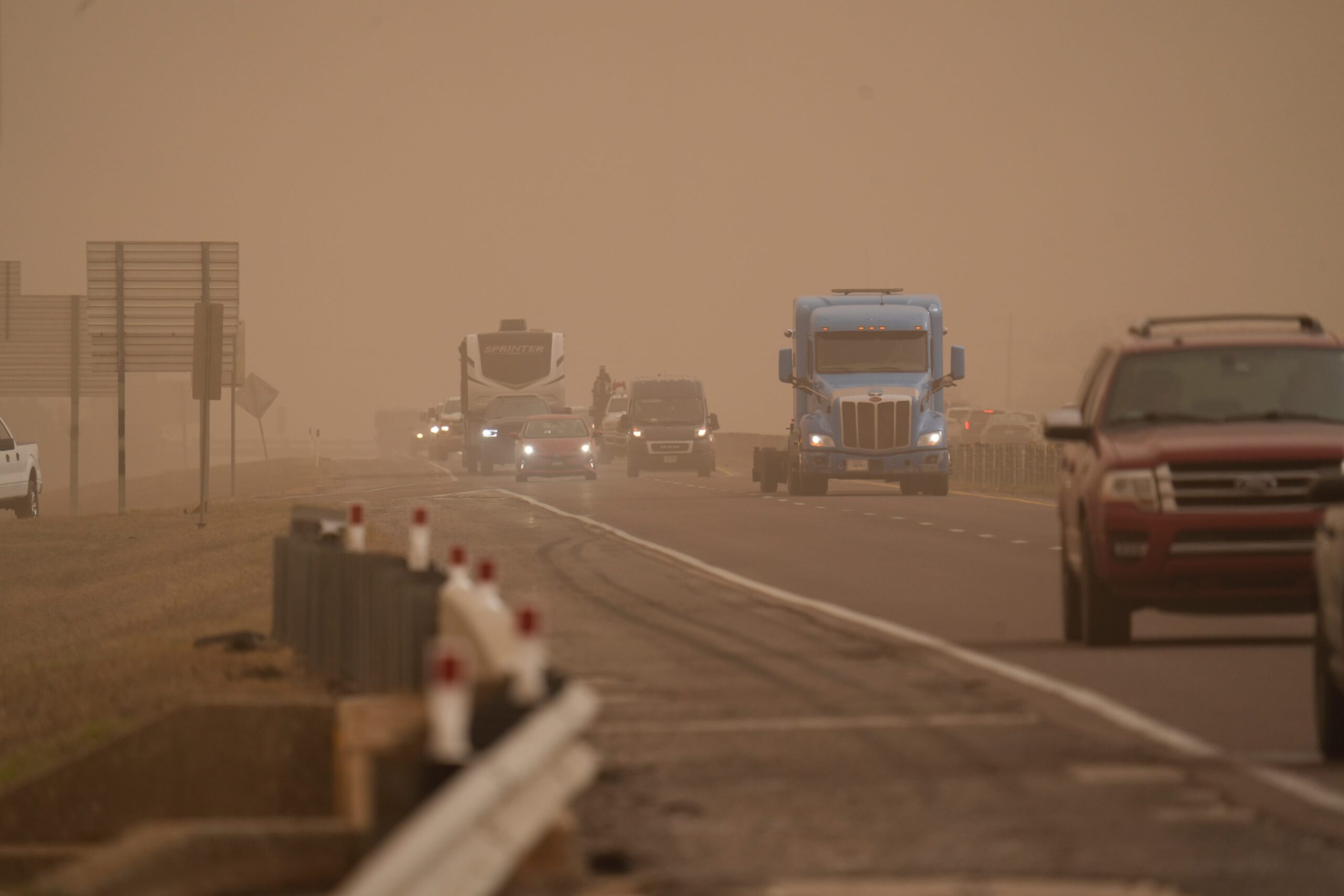
The United States is grappling with the aftermath of a catastrophic weekend that saw a deadly combination of tornadoes, wildfires, and dust storms sweep across the nation, claiming at least 37 lives and leaving hundreds of buildings in ruins. As communities begin the arduous task of recovery, a new threat looms on the horizon: an elevated risk of extreme fire weather across the Central and Southern High Plains.
The National Weather Service (NWS) has issued a critical risk of fire weather for parts of the Central and Southern High Plains on Monday, followed by an even more concerning extreme risk of fire weather over the Southern High Plains on Tuesday. This heightened risk underscores the volatility of current weather patterns and the potential for further devastation in the affected regions.
Red flag warnings are currently in effect for significant portions of Texas, Oklahoma, Kansas, Nebraska, Missouri, and Iowa. These warnings serve as a critical alert to fire managers on federal lands, highlighting conditions that are exceptionally conducive to wildfire ignition and rapid spread. The combination of dry vegetation, strong winds, and low humidity creates a perfect storm for uncontrollable blazes.
The NWS office in Fort Worth/Dallas specifically warned that critical fire conditions will prevail across western North and Central Texas on Monday afternoon and evening. The primary concern stems from extremely low humidity levels coupled with gusty winds, anticipated to reach speeds of 30 to 35 miles per hour. Under these conditions, any fire that ignites would be exceedingly difficult to contain, posing a significant threat to lives and property. Residents in the area are strongly advised to refrain from any outdoor burning activities and to exercise extreme caution when parking or driving vehicles over tall grass, as the hot exhaust systems can easily spark a fire.
Echoing these concerns, the NWS in Des Moines emphasizes that a combination of warm temperatures, persistently low humidity, gusty winds, and the presence of dry or dormant vegetation will create critical fire weather conditions throughout Monday. The convergence of these factors significantly elevates the risk of wildfire outbreaks across the region.
Similarly, in Omaha, Nebraska, a red flag warning is in effect from 10 a.m. to 7 p.m. for a large part of the state. The NWS in Omaha issued a stark warning, stating that fires could start and spread with alarming speed. Rural fire departments are urged to remain on high alert, prepared to respond to potential emergencies with swiftness and efficiency.
The severity of the situation is underscored by the deployment of the National Guard in some areas to assist with disaster relief and emergency response efforts. The scale of the damage caused by the weekend storms necessitates a coordinated and comprehensive response to ensure the safety and well-being of affected communities.
While the High Plains region braces for the potential of wildfires, other parts of the country are facing different weather challenges. The weather service reported that a front extending from the Northeast to the mid-Atlantic coast is expected to move off the East Coast by early Tuesday.
This weather boundary is anticipated to bring much-needed rain to areas stretching from the Northeast to the southern mid-Atlantic Coast by Monday evening, and extending further into the Northeast by Tuesday evening. This precipitation will provide relief from the dry conditions that have plagued some areas and will help to reduce the risk of fire.
However, the rain will not be the only form of precipitation. Light snow is forecast to fall over the Lower Great Lakes and Central Appalachians through late Monday afternoon. In addition, light snow is expected to develop over parts of northern New England from Monday evening into Tuesday morning.
Furthermore, light to moderate snow is also anticipated to develop over parts of the Northern Rockies, Northern Plains, and Upper Mississippi Valley on Monday before moving into the North and Central High Plains by Tuesday evening. This snow could potentially help to mitigate the extreme fire weather risk in those areas, but its impact will depend on the amount of snowfall and the timing of its arrival.
The contrasting weather patterns across the United States highlight the complexity and variability of the nation’s climate. While some regions face the threat of wildfires and drought, others grapple with heavy rain and snow. These extreme weather events serve as a reminder of the importance of preparedness and resilience in the face of a changing climate.
The urgent warnings issued by the National Weather Service underscore the seriousness of the impending fire weather risk in the High Plains. Residents are urged to take all necessary precautions to prevent wildfires, including avoiding outdoor burning, properly disposing of flammable materials, and ensuring that vehicles are properly maintained to prevent sparks.
The combination of a deadly weekend of severe weather and the looming threat of extreme fire weather has created a challenging situation for many communities across the United States. As the nation responds to these crises, it is essential to prioritize public safety, provide assistance to those in need, and work together to build a more resilient future. The coming days will be critical in determining the extent of the damage and the long-term impact of these events. Vigilance and preparedness are paramount as communities face the challenges ahead. The potential for further devastation remains high, highlighting the need for continued monitoring and proactive measures to protect lives and property. The author of this USA Today article is Gabe Hauari, a national trending news reporter.