
Cyclone Alfred Threatens Brisbane, Australia: A Reminder of Unexpected Weather Events
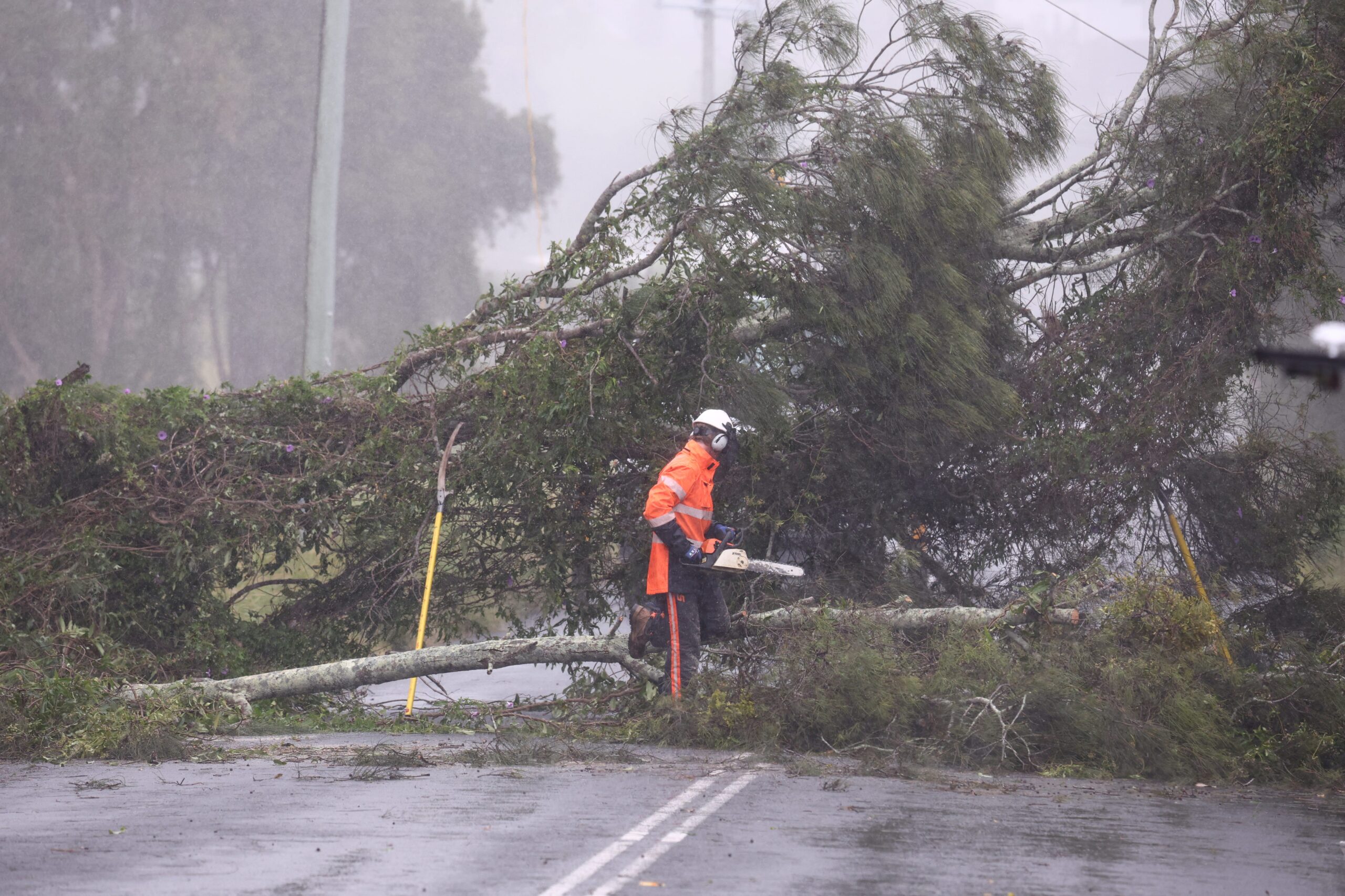
Brisbane, the capital of Queensland, Australia, is bracing for the impact of Cyclone Alfred, a rare weather event that serves as a stark reminder that powerful storms can appear in unexpected locations. While cyclones are not uncommon in other parts of Australia, the impending landfall near Brisbane highlights the vulnerability of even less-frequently affected areas to the destructive forces of nature. The storm is expected to make landfall by Saturday morning, bringing heavy rain, flooding, and damaging winds to the region.
The approaching cyclone has prompted concerns among residents and officials alike, as Brisbane has not experienced a direct hit from a cyclone in over half a century. The last significant cyclone to impact the city was in 1974, leaving a lasting impression on the community. While Brisbane has had near misses with cyclones in 1990 and 2019, the potential for a direct hit from Alfred has heightened the sense of urgency and preparedness.
The rarity of cyclones in the Brisbane area is underscored by Colorado State University hurricane researcher Phil Klotzbach, who noted that the probability of tropical cyclone impacts decreases significantly as you move further south in Australia. The fact that Alfred is targeting the Brisbane metro area is, therefore, an unusual occurrence that warrants attention and caution.
The impending storm is expected to bring significant challenges to the region, with the primary threat being heavy rainfall and widespread flooding. Coastal areas are also bracing for strong wind gusts that could exceed 60 mph. Some parts of northeast New South Wales and southeast Queensland have already received over 4 inches of rain, and forecasters predict that these areas could receive an additional 1-2 feet of rain before the weather system subsides early next week.
The Bureau of Meteorology has warned that the storm’s destructive reach will extend across the border regions of Queensland and New South Wales, exacerbating the potential for widespread damage and disruption. New South Wales Premier Chris Minns characterized Alfred as an "unwanted houseguest" that is overstaying its welcome, highlighting the extended period of disruption that the storm is expected to cause.
Drawing Parallels to Hurricane Hillary: The Element of Surprise
The situation in Brisbane echoes the unexpected arrival of Hurricane Hillary in Southern California in 2023. The rare tropical storm caught many residents off guard, as the region is not typically associated with such weather events. The National Hurricane Center issued a tropical storm warning for Southern California, the first on record, spanning from the Mexico–United States border to north of Los Angeles.
While Eastern Pacific hurricanes typically affect Mexico or dissipate harmlessly over the ocean, Hillary defied expectations and brought significant rainfall and flooding to Southern California. The event served as a stark reminder that even regions not traditionally prone to specific weather hazards can still be vulnerable.
Preparing for the 2025 Atlantic Hurricane Season: A Proactive Approach
As Brisbane prepares for the impact of Cyclone Alfred, residents in the United States are also gearing up for the 2025 Atlantic hurricane season, which begins in less than three months. The National Hurricane Center emphasizes the importance of preparing well in advance of the season’s official start on June 1.
Understanding your home’s vulnerability to storm surge, flooding, and wind is crucial for effective preparation. Residents are encouraged to assess their property and take necessary steps to mitigate potential risks, such as reinforcing roofs, securing windows and doors, and clearing gutters and downspouts.
In addition to protecting your home, it is essential to prepare a go-bag containing essential supplies in case evacuation becomes necessary. The go-bag should include items such as water, food, medications, first-aid supplies, a flashlight, a radio, and important documents.
The Influence of El Niño and La Niña on Hurricane Activity
Colorado State University hurricane researcher Phil Klotzbach is already working on the initial outlook for the 2025 Atlantic hurricane season. One of the critical factors influencing the upcoming season is the potential transition from the current La Niña conditions to El Niño. El Niño and La Niña are climate patterns that significantly impact weather patterns around the world, including the frequency and intensity of hurricanes in the Atlantic basin.
The relationship between these climate patterns and hurricane activity is complex. Generally, La Niña conditions tend to favor a more active hurricane season in the Atlantic, while El Niño conditions can suppress hurricane development. Therefore, the anticipated transition from La Niña to El Niño or a neutral state will play a significant role in determining the severity of the 2025 Atlantic hurricane season.
Conclusion: The Importance of Preparedness and Awareness
The impending landfall of Cyclone Alfred near Brisbane and the unexpected arrival of Hurricane Hillary in Southern California underscore the importance of preparedness and awareness, even in regions not traditionally prone to specific weather hazards. As the 2025 Atlantic hurricane season approaches, residents in vulnerable areas are encouraged to take proactive steps to protect their homes and families. By understanding the potential risks and implementing appropriate safety measures, communities can enhance their resilience and minimize the impact of future weather events. Staying informed about weather forecasts and heeding warnings from local authorities is also crucial for ensuring safety and well-being during severe weather events. The unpredictable nature of weather patterns highlights the need for constant vigilance and preparedness.